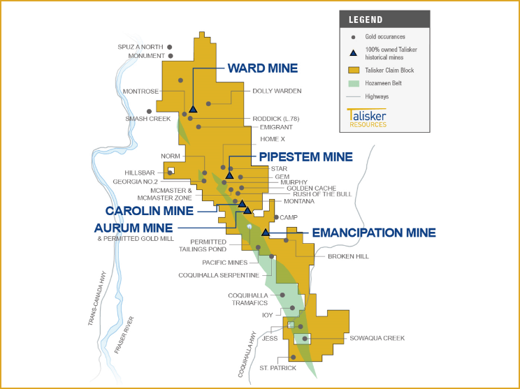
100% Owned District-scale Land Package
(Approx. 144 Sq. kms)
Five Historic Mines and 24 Known Gold Occurrences
Existing Mineral Resources
Mining-Friendly Jurisdiction & Local Community Support
Existing Underground Exploration Permit
Existing Infrastructure & 12 Month Road Access from Highway

Ladner Exploration Upside
- 144 sq. km contiguous land package – approx. 28 km x 5 km, with excellent road infrastructure in place
- Under-explored district scale gold system along Hozameen Fault
- Extensive geological database that includes 600+ drill holes and 50,000+ metres of drilling.
- Recently completed underground survey and updated 3D model
- Airborne Magnetometer survey completed in 2012 over the Ladner Gold Project claim group shows 28 km of ultramafic and sediment
- All known gold zones are associated with the ultramafic contact on the Hozameen Fault and all previous mines and artisan workings are situated on the east side trending NW along the Hozameen Fault

