100% Owned District-scale Land Package
(Approx. 144 Sq. kms)
Five Historic Mines and 24 Known Gold Occurrences
Existing Mineral Resources
Mining-Friendly Jurisdiction & Local Community Support
Existing Underground Exploration Permit
Existing Infrastructure & 12 Month Road Access from Highway
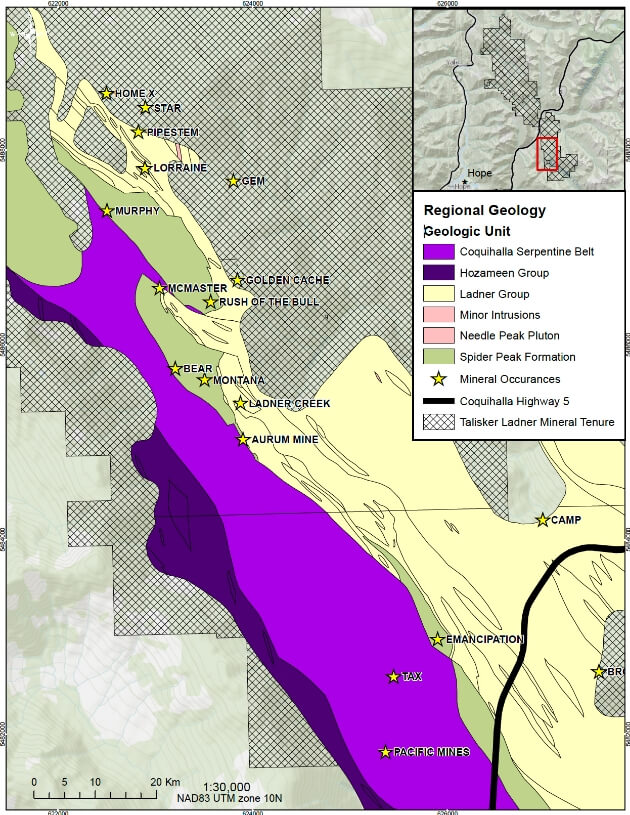
Ladner Gold Geology
- The Ladner Gold Project runs on a NW trend for approx. 28 km along the Hozameen Fault within the Coquihalla Gold Belt
- Exploration has been focused to the Carolin Mine with minor drilling at the McMaster Zones and very sporadic exploration at other key targets
- Large geophysical and geochemical signature
- Recently completed confirmation drilling and updated model
- Metallurgical test work by indicates overall gold recoveries of up to 94.5% possible
- All gold zones are associated with deep first order crustal Hozameen Fault
- Geological model and local structures at the Ladner Gold Project are comparable to Bridge River Gold Camp, Bralorne (4M oz) and California’s Mother Lode District (7M oz producer)