

3.35 M Oz Global Resource (2026 MRE)

High-Grade Resource with an Average Gold Grade of 8.91 g/t (Measured & Indicated, 2026 MRE)

Veins Confirmed to 2 km Depth from Surface

65% Gravity Recoverable Gold Total Recovery above 90%

142 Veins 71 Veins Open Along Strike and at Depth

Consolidated
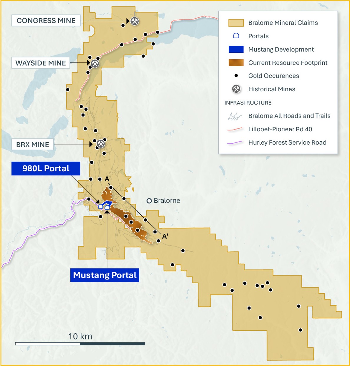
100% Owned 14,000 Ha
Brownfields Camp

47 Historic Gold
Occurrences on 33 km Trend

175,000 m of Modern
Drilling Completed (since 2020)
Bralorne Geology
- The Bralorne Gold Project sits at a terrane boundary between the Bridge River and Cadwallader terranes
- This terrane boundary is marked by Cadwallader ultramafic rocks which sit within a deep crustal scale fault
- Bralorne ore veins are hosted within a lens of competent diorite, granite, and basalt
- These competent rocks are surrounded regionally by less competent sediments, volcanics, and ultramafic silvers which deformed under pressure during accretion and mountain building
- The competent lens hosting the vein deposits fractured rather than bending due to its high strength
- The orogenic fluids, carrying gold, travelled up from depth along the crustal scale fault system and crystallized within the fractures
- Talisker has amalgamated a 33km long belt along the terrane boundary, centered on the world class Bralorne Gold mines, and includes multiple historic gold workings and showings along strike, within favourable host rocks